Midstream Pipeline Services

Keystone Surveying & Mapping performs survey services encompassing all phases of pipeline projects. The following is a list of services KS&M provides to the oil and gas industry:

  • Route Development
  • 1st, 2nd and 3rd order Control Network Surveys
  • Preliminary Corridor Survey
  • Class Study
  • Boundary Surveys and Right of Way Acquisition and Exhibits
  • Title Surveys
  • Certified Plats
  • E&S Permit Package
  • IFC Alignment Sheets
  • HOP Plans
  • Construction Stake Out (Limit of Disturbance) and Facilities Layout
  • Pipeline As-Built Survey (pipe tally inventory reports and post-construction data collection)
  • Pipeline As-Built Alignment Sheets
  • Above Ground Marker AGM Surveys
  • Legacy Mapping for gas distribution lines (update your outdated paper mapping with a survey grade mapping database)
  • Well Pad Preliminary and As-Built surveys (utilizing UAV hardware and software)
  • Well Pad Design
  • Subsidence Monitoring Surveys
  • Topographic Surveys on Slips

Sample Deliverables: PDF Download - SAMPLE

Sample deliverables are available on the desktop version of our website.

Big Pine Gathering System

Big Pine Gathering System™

Project Overview

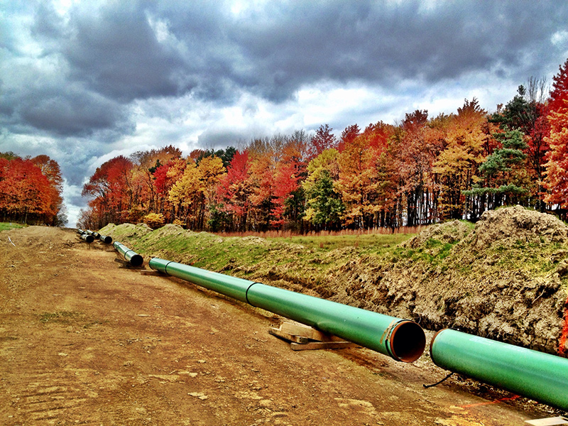
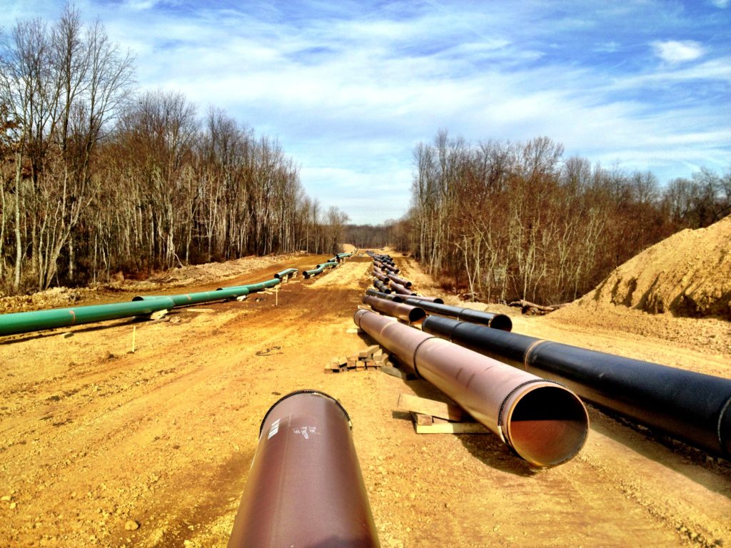
The Big Pine System is 55 miles of 20- and 24-inch gathering pipeline, extending through the heart of the Pennsylvania Marcellus shale play in Butler, Armstrong, Indiana and Westmoreland counties. Gas gathered by the Big Pine System is delivered to three interstate transmission lines located in Butler, Indiana and Westmoreland counties.

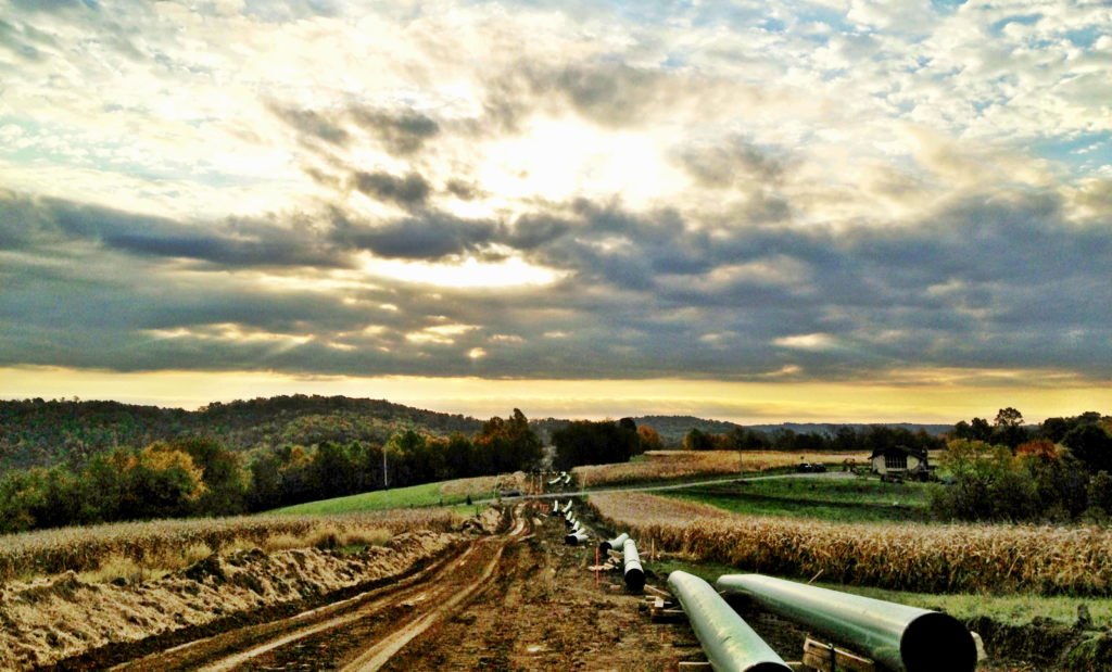
A 10.5 mile extension and expansion that will connect the system to a residue line at MarkWest’s Bluestone Plant in Butler County is currently underway. This ongoing project also includes construction of a compressor station in Armstrong County. Extension and expansion of the line will increase the total capacity by 125,000 dekatherms per day.

Construction Overview

The initial construction of the Big Pine System involved newly built pipeline and several major river crossings. Columbia Midstream met an extremely aggressive schedule to ensure that gas would flow to market the moment producers were ready. This project of exceptional size and scope was delivered in 14 months—an unprecedented accomplishment in the industry.

Hickory Bend

Hickory Bend Gathering System and Cryogenic Processing Plant

After 100 years of experience in the Appalachian Basin, Columbia Midstream is developing partnerships and infrastructure in the emerging shale plays that are being built to last another 100 years.

Project Overview

The scope of the Hickory Bend Project includes approximately 60 miles of 20- and 24-inch wet gas gathering and natural gas liquids pipeline facilities in northeastern Ohio and western Pennsylvania, with capacity of more than 600 million cubic feet of gas per day. It also includes a cryogenic processing facility in Mahoning County, Ohio that processes 200 million cubic feet of gas per day, expandable up to 800 million cubic feet per day.

Construction Overview

As part of the joint venture agreement, Columbia Midstream managed the construction of both the gathering system and processing facility. The project was delivered on-time and on-budget, with more than 300,000 man hours worked and no lost-time incidents.

Keystone Surveying & Mapping Pipeline Job

Ohio River System

Scope

Regency and American Energy-Midstream, LLC are jointly developing a pipeline system to serve the lean natural gas production areas of the Utica Shale in Eastern Ohio. The project, known as the Ohio River System, will include construction of a 52-mile, 36-inch natural gas gathering trunk line through Monroe, Belmont and Jefferson counties that will be capable of delivering up to 2.1 billion cubic feet per day of natural gas to two interstate pipelines located on the southern end of the system in Monroe County (Rockies Express Pipeline and Texas Eastern Transmission). The project will also include the construction of a 25,000 horsepower compressor station in Monroe County.

Keystone Surveying and Mapping Inc. (KSM) provided Preliminary corridor surveying for the permitting package and construction plans and limit of Disturbance stake out along the entire 52 miles.

Project Highlights

KSM prepared a Deed Mosaic encompassing 230 properties through 3 counties. KSM’s final delivery was civil 3D CAD Drawings to the engineering lead (S&ME).

KEYSTONE SURVEYING and MAPPING, Inc.

READY TO GET STARTED? CALL 724-514-7949